
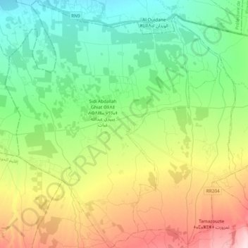
caïdat de Sidi Abdellah Ghiat topographic map
Interactive map
Click on the map to display elevation.
About this map
Name: caïdat de Sidi Abdellah Ghiat topographic map, elevation, terrain.
Average elevation: 608 m
Minimum elevation: 503 m
Maximum elevation: 801 m
Other topographic maps
Click on a map to view its topography, its elevation and its terrain.
Ait Sidi Daoud
Ait Sidi Daoud, caïdat de Faska Sidi Daoud, cercle d'Aït Ourir, Province d'Al Haouz, Marrakech-Safi, Maroc
Average elevation: 626 m