
Masera topographic map
Interactive map
Click on the map to display elevation.
About this map
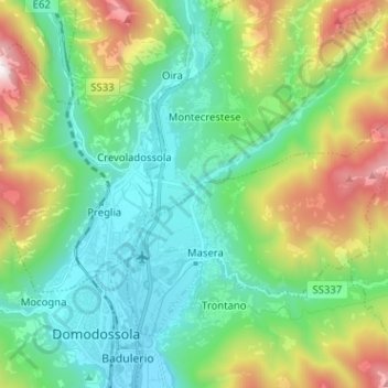
Name: Masera topographic map, elevation, terrain.
Location: Masera, Verbano-Cusio-Ossola, Piemont, 28855, Italy (46.11554 8.30134 46.17997 8.42842)
Average elevation: 755 m
Minimum elevation: 250 m
Maximum elevation: 2,009 m