
Makueni topographic map
Interactive map
Click on the map to display elevation.
About this map
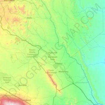
Name: Makueni topographic map, elevation, terrain.
Location: Makueni, Kenya (-2.99462 37.14271 -1.51762 38.52051)
Average elevation: 993 m
Minimum elevation: 383 m
Maximum elevation: 3,800 m