
Sungai Galing Park topographic map
Interactive map
Click on the map to display elevation.
About this map
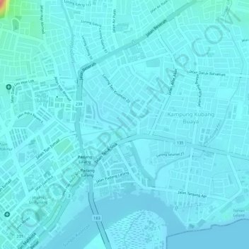
Name: Sungai Galing Park topographic map, elevation, terrain.
Average elevation: 8 m
Minimum elevation: 0 m
Maximum elevation: 88 m
Other topographic maps
Click on a map to view its topography, its elevation and its terrain.
Gelora Park
Gelora Park, Kampung Kubang Buaya, Kuantan, Pahang, Malaysia
Average elevation: 4 m
Teluk Cempedak
Teluk Cempedak, Kuantan, Pahang, 25050, Malaysia
Average elevation: 19 m
Sungai Kuantan
Sungai Kuantan, Kuantan, Pahang, 26200, Malaysia
Average elevation: 52 m
Berkelah Falls
Berkelah Falls, Kuantan, Pahang, Malaysia
Average elevation: 404 m
Berkelah Falls Upper Tier
Berkelah Falls Upper Tier, Kuantan, Pahang, Malaysia
Average elevation: 472 m
Air Terjun Sungei Pandan
Air Terjun Sungei Pandan, Kuantan, Pahang, 26140, Malaysia
Average elevation: 129 m