
Thank you for supporting this site ❤️
Make a donation
Make a donation
El Cinco topographic map
Click on the map to display elevation.
Thank you for supporting this site ❤️
Make a donation
Make a donation
About this map
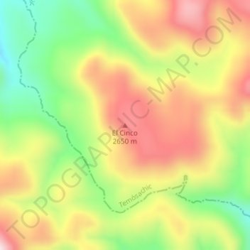
Name: El Cinco topographic map, elevation, terrain.
Location: El Cinco, Temósachic, Chihuahua, Mexico (28.31066 -108.15506 28.31076 -108.15496)
Average elevation: 2,513 m
Minimum elevation: 2,302 m
Maximum elevation: 2,716 m
Thank you for supporting this site ❤️
Make a donation
Make a donation