
Hillegem topographic map
Interactive map
Click on the map to display elevation.
About this map
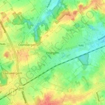
Name: Hillegem topographic map, elevation, terrain.
Location: Hillegem, Herzele, Oost-Vlaanderen, Vlaanderen, 9550, België (50.87581 3.83357 50.91581 3.87357)
Average elevation: 62 m
Minimum elevation: 39 m
Maximum elevation: 88 m