
Rundle Range National Park topographic map
Interactive map
Click on the map to display elevation.
About this map
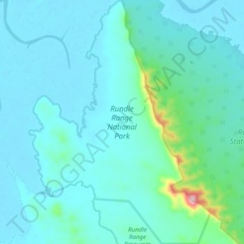
Name: Rundle Range National Park topographic map, elevation, terrain.
Average elevation: 31 m
Minimum elevation: -3 m
Maximum elevation: 260 m
Other topographic maps
Click on a map to view its topography, its elevation and its terrain.
Mount Despair
Australia > Queensland > Gladstone
Mount Despair, Gladstone, Queensland, Australia
Average elevation: 108 m
Lake Awoonga
Australia > Queensland > Gladstone
Lake Awoonga, Gladstone, Queensland, Australia
Average elevation: 104 m
Mount Stanley
Australia > Queensland > Gladstone
Mount Stanley, Gladstone, Queensland, Australia
Average elevation: 378 m