
La Laborcilla topographic map
Interactive map
Click on the map to display elevation.
About this map
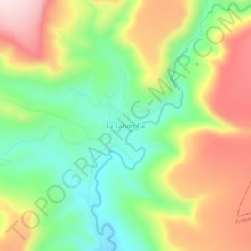
Name: La Laborcilla topographic map, elevation, terrain.
Location: La Laborcilla, El Marqués, Querétaro, Mexico (20.84991 -100.31060 20.88991 -100.27060)
Average elevation: 2,310 m
Minimum elevation: 2,126 m
Maximum elevation: 2,547 m
Other topographic maps
Click on a map to view its topography, its elevation and its terrain.
San José Navajas
Mexico > Querétaro > El Marqués
San José Navajas, El Marqués, Querétaro, 76278, Mexico
Average elevation: 1,926 m