
Oued Martil topographic map
Interactive map
Click on the map to display elevation.
About this map
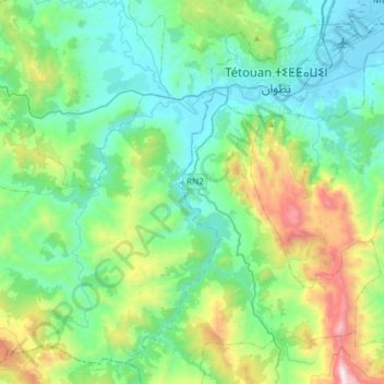
Name: Oued Martil topographic map, elevation, terrain.
Average elevation: 355 m
Minimum elevation: -1 m
Maximum elevation: 1,549 m
Other topographic maps
Click on a map to view its topography, its elevation and its terrain.
Souk Kdim
Maroc > Cercle de Jebala دائرة جبالة
Souk Kdim, caïdat de Ain Lahcen, Cercle de Jebala دائرة جبالة, Province de Tétouan, Tanger-Tétouan-Al Hoceïma, Maroc
Average elevation: 190 m