
Đức Hòa District topographic map
Interactive map
Click on the map to display elevation.
About this map
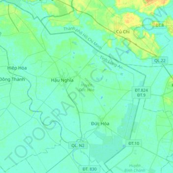
Name: Đức Hòa District topographic map, elevation, terrain.
Location: Đức Hòa District, Long An Province, 82719, Vietnam (10.74090 106.27082 11.02578 106.53323)
Average elevation: 4 m
Minimum elevation: -2 m
Maximum elevation: 22 m