
Tandridge District topographic map
Interactive map
Click on the map to display elevation.
About this map
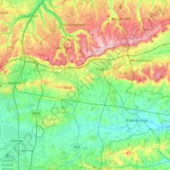
Name: Tandridge District topographic map, elevation, terrain.
Average elevation: 114 m
Minimum elevation: 34 m
Maximum elevation: 271 m
The district contains parts of the North Downs Area of Outstanding Natural Beauty and the Weald. It also contains several woodlands and some open heathland. Elevations above sea level range from 267 m (876 ft) at Botley Hill, in the North Downs near Oxted, to 42 m (138 ft) near Edenbridge.
Other topographic maps
Click on a map to view its topography, its elevation and its terrain.
Nutfield
United Kingdom > England > Surrey > Tandridge District
Nutfield, Tandridge District, Surrey, England, United Kingdom
Average elevation: 88 m
Warlingham
United Kingdom > England > Surrey > Tandridge District
Warlingham, Tandridge District, Surrey, England, United Kingdom
Average elevation: 163 m
Caterham
United Kingdom > England > Surrey > Tandridge District
Caterham, Tandridge District, Surrey, England, CR3 6XS, United Kingdom
Average elevation: 157 m