
Leskovac topographic map
Interactive map
Click on the map to display elevation.
About this map
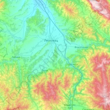
Name: Leskovac topographic map, elevation, terrain.
Location: Leskovac, Јабланички управни округ, Serbie centrale, Serbie (42.68989 21.70324 43.17077 22.22889)
Average elevation: 562 m
Minimum elevation: 198 m
Maximum elevation: 1,710 m
Other topographic maps
Click on a map to view its topography, its elevation and its terrain.
Лозане
Serbie > Serbie centrale > Јабланички управни округ > Општина Бојник
Лозане, Општина Бојник, Јабланички управни округ, Serbie centrale, Serbie
Average elevation: 451 m