
Plagne Soleil topographic map
Interactive map
Click on the map to display elevation.
About this map
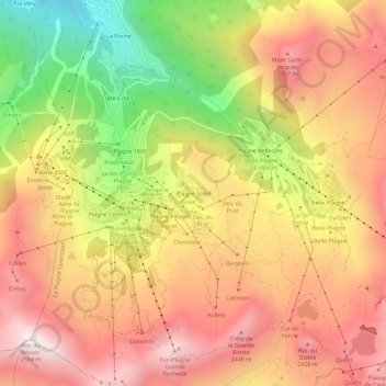
Name: Plagne Soleil topographic map, elevation, terrain.
Average elevation: 2,094 m
Minimum elevation: 1,453 m
Maximum elevation: 2,561 m
Other topographic maps
Click on a map to view its topography, its elevation and its terrain.
Le Gothard
France > Auvergne-Rhône-Alpes > Savoie > La Plagne-Tarentaise
Le Gothard, Bellentre, La Plagne-Tarentaise, Albertville, Savoie, Auvergne-Rhône-Alpes, France métropolitaine, 73210, France
Average elevation: 1,067 m
Belle Plagne
France > Auvergne-Rhône-Alpes > Savoie > La Plagne-Tarentaise > Belle Plagne
Belle Plagne, Mâcot-la-Plagne, La Plagne-Tarentaise, Albertville, Savoie, Auvergne-Rhône-Alpes, France métropolitaine, 73210, France
Average elevation: 2,204 m