
Fekrane topographic map
Interactive map
Click on the map to display elevation.
About this map
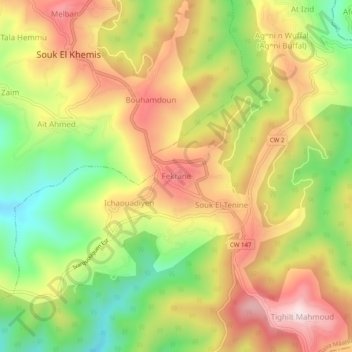
Name: Fekrane topographic map, elevation, terrain.
Average elevation: 514 m
Minimum elevation: 281 m
Maximum elevation: 738 m
Other topographic maps
Click on a map to view its topography, its elevation and its terrain.
Mâatkas
Algérie > Tizi Ouzou > Daïra Mâatkas > Mâatkas
Mâatkas, Daïra Mâatkas, Tizi Ouzou, Algérie
Average elevation: 391 m