
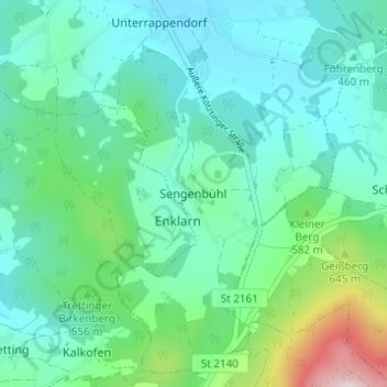
Sengenbühl topographic map
Interactive map
Click on the map to display elevation.
About this map
Name: Sengenbühl topographic map, elevation, terrain.
Average elevation: 513 m
Minimum elevation: 403 m
Maximum elevation: 929 m
Other topographic maps
Click on a map to view its topography, its elevation and its terrain.
Dieberg
Deutschland > Bayern > Landkreis Cham > Furth im Wald
Dieberg, Furth im Wald, Landkreis Cham, Bayern, 93437, Deutschland
Average elevation: 469 m
Lixenried
Deutschland > Bayern > Landkreis Cham > Furth im Wald
Lixenried, Furth im Wald, Landkreis Cham, Bayern, 93477, Deutschland
Average elevation: 509 m