
Kansas topographic map
Interactive map
Click on the map to display elevation.
About this map
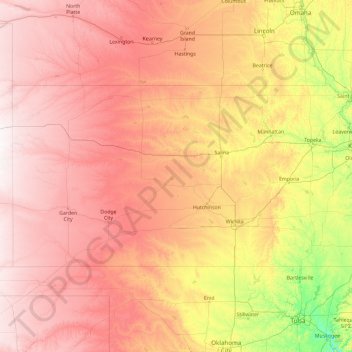
Name: Kansas topographic map, elevation, terrain.
Location: Kansas, United States of America (36.99313 -102.05176 40.00310 -94.58820)
Average elevation: 601 m
Minimum elevation: 150 m
Maximum elevation: 1,302 m
The western two-thirds of the state, lying in the great central plain of the United States, has a generally flat or undulating surface, while the eastern third has many hills and forests. The land gradually rises from east to west; its altitude ranges from 684 ft (208 m) along the Verdigris River at Coffeyville in Montgomery County, to 4,039 ft (1,231 m) at Mount Sunflower, 0.5 miles (0.80 kilometers) from the Colorado border, in Wallace County. It is a common misconception that Kansas is the flattest state in the nation – in 2003, a tongue-in-cheek study famously declared the state "flatter than a pancake". In fact, Kansas has a maximum topographic relief of 3,360 ft (1,020 m), making it the 23rd flattest U.S. state measured by maximum relief.