
La Pommeraye topographic map
Interactive map
Click on the map to display elevation.
About this map
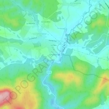
Name: La Pommeraye topographic map, elevation, terrain.
Average elevation: 398 m
Minimum elevation: 342 m
Maximum elevation: 553 m
Other topographic maps
Click on a map to view its topography, its elevation and its terrain.
La Louvière
France > Bourgogne-Franche-Comté > Haute-Saône > Chenebier
La Louvière, Chenebier, Lure, Haute-Saône, Bourgogne-Franche-Comté, France métropolitaine, 70400, France
Average elevation: 388 m