
Cope topographic map
Interactive map
Click on the map to display elevation.
About this map
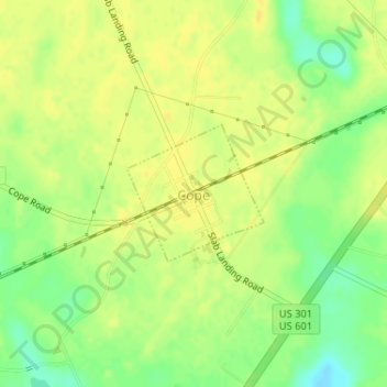
Name: Cope topographic map, elevation, terrain.
Location: Cope, Orangeburg County, South Carolina, United States (33.37326 -81.01262 33.38283 -81.00116)
Average elevation: 58 m
Minimum elevation: 42 m
Maximum elevation: 65 m
Other topographic maps
Click on a map to view its topography, its elevation and its terrain.
Livingston
United States > South Carolina > Orangeburg County
Livingston, Orangeburg County, South Carolina, United States
Average elevation: 95 m
Forest Lake Estates
United States > South Carolina > Orangeburg County
Forest Lake Estates, Orangeburg County, South Carolina, 29118, United States
Average elevation: 76 m
Orangeburg
United States > South Carolina > Orangeburg County > Orangeburg
Orangeburg, Orangeburg County, South Carolina, United States
Average elevation: 64 m