
South Dennis topographic map
Interactive map
Click on the map to display elevation.
About this map
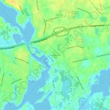
Name: South Dennis topographic map, elevation, terrain.
Average elevation: 9 m
Minimum elevation: -3 m
Maximum elevation: 23 m
Other topographic maps
Click on a map to view its topography, its elevation and its terrain.
North Dennis
United States > Massachusetts > Barnstable County > Dennis
North Dennis, Dennis, Barnstable County, Massachusetts, 02638, United States
Average elevation: 2 m
Dennis Port
United States > Massachusetts > Barnstable County > Dennis
Dennis Port, Dennisport, Dennis, Barnstable County, Massachusetts, 02639, United States
Average elevation: 3 m