
Le Château topographic map
Interactive map
Click on the map to display elevation.
About this map
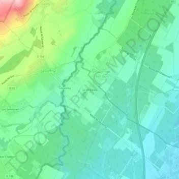
Name: Le Château topographic map, elevation, terrain.
Location: Le Château, Versoix, Genève, 1290, Suisse (46.29118 6.10853 46.33118 6.14853)
Average elevation: 469 m
Minimum elevation: 418 m
Maximum elevation: 617 m
Other topographic maps
Click on a map to view its topography, its elevation and its terrain.
Lac Léman (GE)
Lac Léman (GE), Versoix, Genève, 1290, Suisse
Average elevation: 373 m