
La Coulée Verte topographic map
Interactive map
Click on the map to display elevation.
About this map
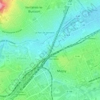
Name: La Coulée Verte topographic map, elevation, terrain.
Average elevation: 80 m
Minimum elevation: 52 m
Maximum elevation: 161 m
Other topographic maps
Click on a map to view its topography, its elevation and its terrain.
Château de Vilgénis
France > Île-de-France > Essonne > Massy
Château de Vilgénis, Allée de l'Impératrice Eugénie, Le Pileu, Massy, Palaiseau, Essonne, Île-de-France, France métropolitaine, 91300, France
Average elevation: 96 m