
Long Eaton topographic map
Interactive map
Click on the map to display elevation.
About this map
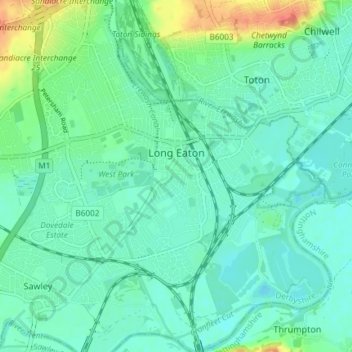
Name: Long Eaton topographic map, elevation, terrain.
Location: Long Eaton, Erewash, Derbyshire, England, United Kingdom (52.87329 -1.30594 52.91789 -1.23840)
Average elevation: 35 m
Minimum elevation: 22 m
Maximum elevation: 75 m
Other topographic maps
Click on a map to view its topography, its elevation and its terrain.
Ilkeston
United Kingdom > England > Derbyshire > Erewash > Ilkeston
Ilkeston, Erewash, Derbyshire, East Midlands, England, DE7 5JA, United Kingdom
Average elevation: 81 m