
Rowsley CP topographic map
Interactive map
Click on the map to display elevation.
About this map
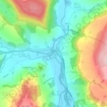
Name: Rowsley CP topographic map, elevation, terrain.
Average elevation: 181 m
Minimum elevation: 95 m
Maximum elevation: 327 m
Other topographic maps
Click on a map to view its topography, its elevation and its terrain.
Ashbourne CP
United Kingdom > England > Derbyshire > Derbyshire Dales > Compton
Ashbourne CP, Compton, Derbyshire Dales, Derbyshire, England, United Kingdom
Average elevation: 147 m
Tideswell CP
United Kingdom > England > Derbyshire > Derbyshire Dales > Tideswell CP
Tideswell CP, Derbyshire Dales, Derbyshire, East Midlands, England, United Kingdom
Average elevation: 321 m