
Halde Radbod topographic map
Interactive map
Click on the map to display elevation.
About this map
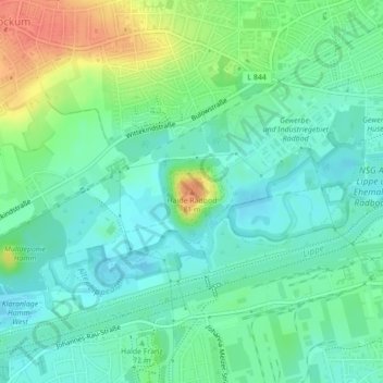
Name: Halde Radbod topographic map, elevation, terrain.
Location: Halde Radbod, Hamm, Nordrhein-Westfalen, 59075, Deutschland (51.68293 7.75312 51.68303 7.75322)
Average elevation: 62 m
Minimum elevation: 46 m
Maximum elevation: 95 m