
Vosburgh Swamp Wildlife Management Area topographic map
Interactive map
Click on the map to display elevation.
About this map
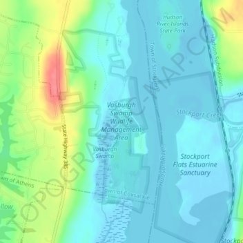
Name: Vosburgh Swamp Wildlife Management Area topographic map, elevation, terrain.
Average elevation: 16 m
Minimum elevation: -6 m
Maximum elevation: 67 m
Other topographic maps
Click on a map to view its topography, its elevation and its terrain.
Climax
United States > New York > Greene County > Town of Coxsackie
Climax, Town of Coxsackie, Greene County, New York, 12051, United States
Average elevation: 88 m
Result
United States > New York > Greene County > Town of Coxsackie
Result, Town of Coxsackie, Greene County, New York, 12058, United States
Average elevation: 189 m
Earlton
United States > New York > Greene County > Town of Coxsackie
Earlton, Town of Coxsackie, Greene County, New York, 12058, United States
Average elevation: 158 m