
Stokkem topographic map
Interactive map
Click on the map to display elevation.
About this map
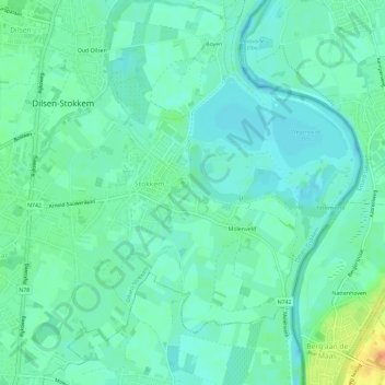
Name: Stokkem topographic map, elevation, terrain.
Location: Stokkem, Dilsen-Stokkem, Maaseik, Limburg, België (51.00153 5.72456 51.03830 5.77643)
Average elevation: 35 m
Minimum elevation: 25 m
Maximum elevation: 49 m
Other topographic maps
Click on a map to view its topography, its elevation and its terrain.