
Lampung Utara topographic map
Interactive map
Click on the map to display elevation.
About this map
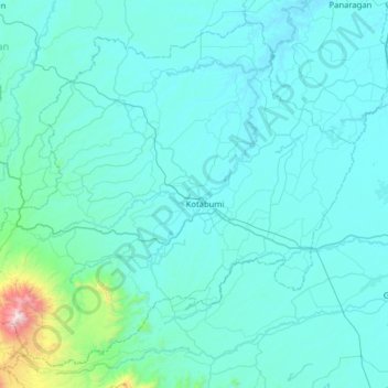
Name: Lampung Utara topographic map, elevation, terrain.
Location: Lampung Utara, Lampung, Indonesia (-5.08951 104.49240 -4.52765 105.12704)
Average elevation: 128 m
Minimum elevation: 5 m
Maximum elevation: 2,061 m