
Tacmara topographic map
Interactive map
Click on the map to display elevation.
About this map
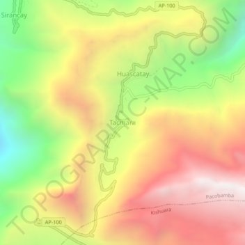
Name: Tacmara topographic map, elevation, terrain.
Location: Tacmara, Andahuaylas, Apurímac, Pérou (-13.52966 -73.20816 -13.48966 -73.16816)
Average elevation: 3,635 m
Minimum elevation: 2,717 m
Maximum elevation: 4,443 m