Geolocate

Newcastle topographic map

Interactive map

Click on the map to display elevation.

Newcastle topographic map, elevation, terrain

Newcastle topographic map, elevation, terrain

About this map

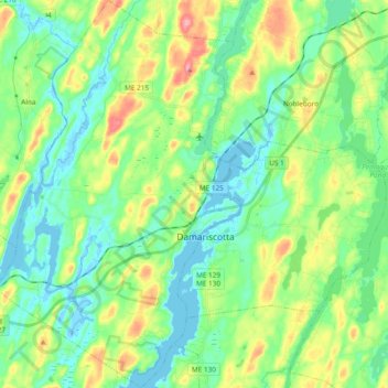
Name: Newcastle topographic map, elevation, terrain.

Location: Newcastle, Lincoln County, Maine, 04553, United States (43.97978 -69.63783 44.11564 -69.51399)

Average elevation: 31 m

Minimum elevation: -4 m

Maximum elevation: 101 m

Other topographic maps

Click on a map to view its topography, its elevation and its terrain.

Bremen

United States > Maine > Lincoln County

Average elevation: 21 m

Bristol

United States > Maine > Lincoln County

Average elevation: 13 m

Damariscotta

United States > Maine > Lincoln County

According to the United States Census Bureau, the town has a total area of 14.71 square miles (38.10 km2), of which 12.42 square miles (32.17 km2) is land and 2.29 square miles (5.93 km2) is water. Damariscotta is situated on the Damariscotta River, a tidal estuary of the Gulf of Maine. Hunt Hill, at an…

Average elevation: 29 m

Nobleboro

United States > Maine > Lincoln County

Average elevation: 40 m

Waldoboro

United States > Maine > Lincoln County

Average elevation: 40 m

Jefferson

United States > Maine > Lincoln County

Average elevation: 60 m

Whitefield

United States > Maine > Lincoln County

Average elevation: 60 m