
Stade topographic map
Interactive map
Click on the map to display elevation.
About this map
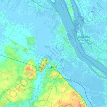
Name: Stade topographic map, elevation, terrain.
Location: Stade, Niedersachsen, Germania (53.53861 9.37386 53.70120 9.55063)
Average elevation: 4 m
Minimum elevation: -5 m
Maximum elevation: 35 m