
Reguengo topographic map
Interactive map
Click on the map to display elevation.
About this map
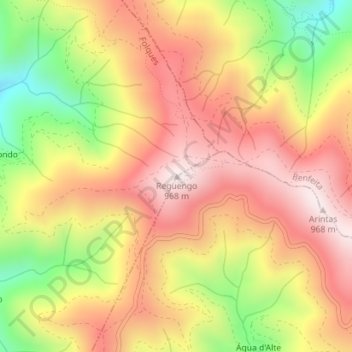
Name: Reguengo topographic map, elevation, terrain.
Average elevation: 723 m
Minimum elevation: 393 m
Maximum elevation: 963 m
Other topographic maps
Click on a map to view its topography, its elevation and its terrain.
Cepos
Portugal > Centro > Cepos e Teixeira
Cepos, Cepos e Teixeira, Arganil, Coimbra, Pinhal Interior Norte, Centro, Portugal
Average elevation: 581 m
Relvas
Portugal > Centro > Cepos e Teixeira > Relvas
Relvas, Teixeira, Cepos e Teixeira, Arganil, Coimbra, Pinhal Interior Norte, Centro, 3320-076, Portugal
Average elevation: 655 m
Catraia
Portugal > Centro > Cepos e Teixeira
Catraia, Cepos e Teixeira, Arganil, Coimbra, Pinhal Interior Norte, Centro, 3320-076, Portugal
Average elevation: 692 m