
Ghlin topographic map
Interactive map
Click on the map to display elevation.
About this map
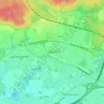
Name: Ghlin topographic map, elevation, terrain.
Location: Ghlin, Bergen, Henegouwen, Wallonië, 7011, België (50.45605 3.88375 50.49605 3.92375)
Average elevation: 39 m
Minimum elevation: 17 m
Maximum elevation: 90 m