
Derby topographic map
Interactive map
Click on the map to display elevation.
About this map
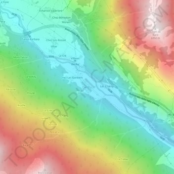
Name: Derby topographic map, elevation, terrain.
Location: Derby, La Salle, Valle d'Aosta, 11015, Italia (45.70433 7.07047 45.74433 7.11047)
Average elevation: 1,349 m
Minimum elevation: 769 m
Maximum elevation: 2,249 m