
Castelo topographic map
Interactive map
Click on the map to display elevation.
About this map
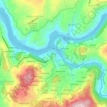
Name: Castelo topographic map, elevation, terrain.
Location: Castelo, Fornos, Castelo de Paiva, Aveiro, 4550-100, Portugal (41.04356 -8.28147 41.08356 -8.24147)
Average elevation: 125 m
Minimum elevation: 10 m
Maximum elevation: 327 m