
Strümpfelbrunn topographic map
Interactive map
Click on the map to display elevation.
About this map
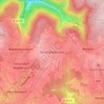
Name: Strümpfelbrunn topographic map, elevation, terrain.
Average elevation: 483 m
Minimum elevation: 230 m
Maximum elevation: 580 m
Other topographic maps
Click on a map to view its topography, its elevation and its terrain.
Ravenstein
Duitsland > Baden-Württemberg > Neckar-Odenwald-Kreis
Ravenstein, Verwaltungsverband Osterburken, Neckar-Odenwald-Kreis, Baden-Württemberg, 74747, Duitsland
Average elevation: 332 m