
Distrito Santa Isabel topographic map
Interactive map
Click on the map to display elevation.
About this map
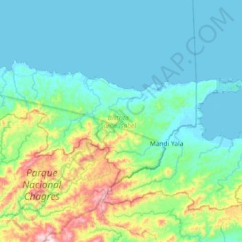
Name: Distrito Santa Isabel topographic map, elevation, terrain.
Location: Distrito Santa Isabel, Colón, Panama (9.35299 -79.58517 9.60457 -79.08023)
Average elevation: 166 m
Minimum elevation: 0 m
Maximum elevation: 978 m
Other topographic maps
Click on a map to view its topography, its elevation and its terrain.