
Puerto Vallarta topographic map
Interactive map
Click on the map to display elevation.
About this map
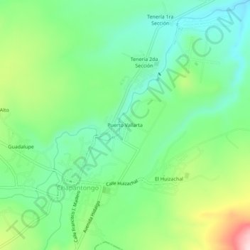
Name: Puerto Vallarta topographic map, elevation, terrain.
Location: Puerto Vallarta, Chapantongo, Hidalgo, Mexique (20.27444 -99.42417 20.31444 -99.38417)
Average elevation: 2,141 m
Minimum elevation: 2,049 m
Maximum elevation: 2,331 m