
Bageshwar topographic map
Interactive map
Click on the map to display elevation.
About this map
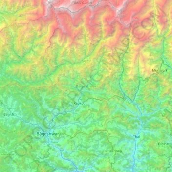
Name: Bageshwar topographic map, elevation, terrain.
Location: Bageshwar, Uttarakhand, India (29.70002 79.47218 30.31683 80.15917)
Average elevation: 2,409 m
Minimum elevation: 722 m
Maximum elevation: 7,084 m
Other topographic maps
Click on a map to view its topography, its elevation and its terrain.