
Bruchhausen topographic map
Interactive map
Click on the map to display elevation.
About this map
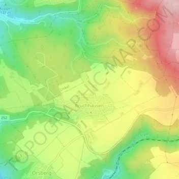
Name: Bruchhausen topographic map, elevation, terrain.
Location: Bruchhausen, Unkel, Landkreis Neuwied, Rijnland-Palts, Duitsland (50.59515 7.24273 50.61470 7.27845)
Average elevation: 193 m
Minimum elevation: 80 m
Maximum elevation: 315 m
Other topographic maps
Click on a map to view its topography, its elevation and its terrain.
Neuwied
Duitsland > Rijnland-Palts > Landkreis Neuwied > Neuwied
Neuwied, Landkreis Neuwied, Rijnland-Palts, Duitsland
Average elevation: 172 m