
Saint-Pierre topographic map
Interactive map
Click on the map to display elevation.
About this map
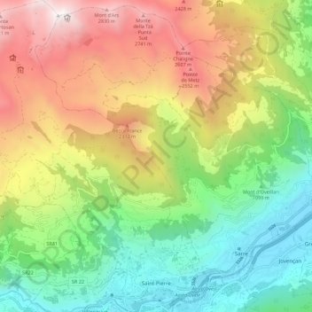
Name: Saint-Pierre topographic map, elevation, terrain.
Location: Saint-Pierre, Valle d'Aosta, Italia (45.70241 7.15316 45.77912 7.24782)
Average elevation: 1,577 m
Minimum elevation: 579 m
Maximum elevation: 3,029 m