
Red Deer Lake topographic map
Interactive map
Click on the map to display elevation.
About this map
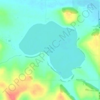
Name: Red Deer Lake topographic map, elevation, terrain.
Location: Red Deer Lake, Foothills County, Alberta, Canada (50.86345 -114.17484 50.87911 -114.14643)
Average elevation: 1,140 m
Minimum elevation: 1,123 m
Maximum elevation: 1,185 m
Other topographic maps
Click on a map to view its topography, its elevation and its terrain.
Cayley
Canada > Alberta > Foothills County
Cayley, Foothills County, Alberta, Canada
Average elevation: 1,070 m
Millarville
Canada > Alberta > Foothills County
Millarville, Foothills County, Alberta, T0L 1K0, Canada
Average elevation: 1,220 m