
Egypt topographic map
Interactive map
Click on the map to display elevation.
About this map
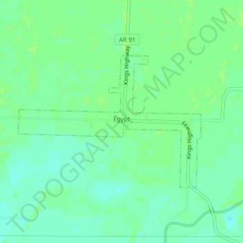
Name: Egypt topographic map, elevation, terrain.
Location: Egypt, Craighead County, Arkansas, 72427, United States (35.86048 -90.95986 35.87515 -90.93477)
Average elevation: 76 m
Minimum elevation: 70 m
Maximum elevation: 79 m
Other topographic maps
Click on a map to view its topography, its elevation and its terrain.
Gibson
United States > Arkansas > Craighead County
Gibson, Craighead County, Arkansas, United States
Average elevation: 78 m
Cash
United States > Arkansas > Craighead County
Cash, Craighead County, Arkansas, 72421, United States
Average elevation: 75 m
Valley View
United States > Arkansas > Craighead County > Jonesboro
Valley View, Jonesboro, Craighead County, Arkansas, United States
Average elevation: 97 m
Jonesboro
United States > Arkansas > Craighead County
Jonesboro, Craighead County, Arkansas, United States
Average elevation: 89 m
Bay
United States > Arkansas > Craighead County
Bay, Craighead County, Arkansas, 72411, United States
Average elevation: 69 m
Lake City
United States > Arkansas > Craighead County
Lake City, Craighead County, Arkansas, 72437, United States
Average elevation: 69 m
Brookland
United States > Arkansas > Craighead County > Brookland
Brookland, Craighead County, Arkansas, 72417, United States
Average elevation: 83 m
Philadelphia
United States > Arkansas > Craighead County > Jonesboro > Philadelphia
Philadelphia, Jonesboro, Craighead County, Arkansas, 72401-0391, United States
Average elevation: 106 m
Cash
United States > Arkansas > Craighead County > Cash > Cash
Cash, Craighead County, Arkansas, 72421, United States
Average elevation: 75 m