
La Mazure topographic map
Interactive map
Click on the map to display elevation.
About this map
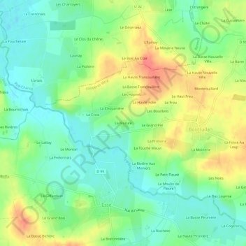
Name: La Mazure topographic map, elevation, terrain.
Average elevation: 54 m
Minimum elevation: 30 m
Maximum elevation: 89 m
Other topographic maps
Click on a map to view its topography, its elevation and its terrain.
Launay
France > Bretagne > Ille-et-Vilaine > Boistrudan
Launay, Boistrudan, Fougères-Vitré, Ille-et-Vilaine, Bretagne, France métropolitaine, 35150, France
Average elevation: 56 m