
Crasto topographic map
Interactive map
Click on the map to display elevation.
About this map
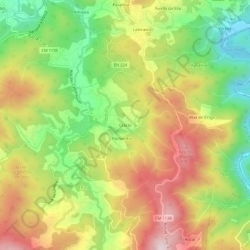
Name: Crasto topographic map, elevation, terrain.
Location: Crasto, Real, Castelo de Paiva, Aveiro, 4550-226, Portugal (40.99286 -8.28143 41.03286 -8.24143)
Average elevation: 272 m
Minimum elevation: 39 m
Maximum elevation: 521 m
Other topographic maps
Click on a map to view its topography, its elevation and its terrain.
Gilde
Portugal > Aveiro > Castelo de Paiva > Real
Gilde, Real, Castelo de Paiva, Aveiro, 4540-610, Portugal
Average elevation: 317 m