
Förstgen topographic map
Interactive map
Click on the map to display elevation.
About this map
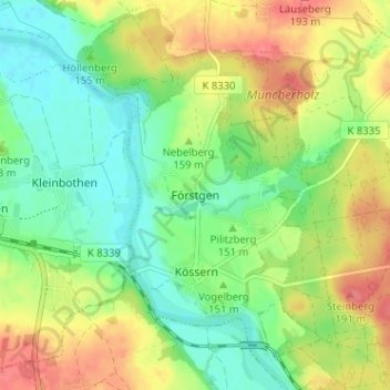
Name: Förstgen topographic map, elevation, terrain.
Location: Förstgen, Grimma, Landkreis Leipzig, Sachsen, Deutschland (51.16913 12.76574 51.20913 12.80574)
Average elevation: 155 m
Minimum elevation: 128 m
Maximum elevation: 191 m