
Thank you for supporting this site ❤️
Make a donation
Make a donation
Gwebi topographic map
Click on the map to display elevation.
Thank you for supporting this site ❤️
Make a donation
Make a donation
About this map
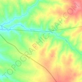
Name: Gwebi topographic map, elevation, terrain.
Location: Gwebi, Zvimba, Mashonaland West, Zimbabwe (-17.60976 30.64335 -17.56504 30.75912)
Average elevation: 1,415 m
Minimum elevation: 1,377 m
Maximum elevation: 1,457 m
Thank you for supporting this site ❤️
Make a donation
Make a donation
Other topographic maps
Click on a map to view its topography, its elevation and its terrain.