
Banton Island topographic map
Interactive map
Click on the map to display elevation.
About this map
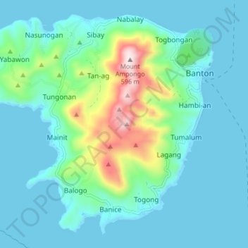
Name: Banton Island topographic map, elevation, terrain.
Location: Banton Island, Banton, Romblon, Mimaropa, Philippines (12.90495 122.03272 12.96269 122.09949)
Average elevation: 104 m
Minimum elevation: 0 m
Maximum elevation: 596 m
Other topographic maps
Click on a map to view its topography, its elevation and its terrain.
Carabao Island
Carabao Island, San Jose, Romblon, Mimaropa, 5510, Philippines
Average elevation: 37 m