
Tigrigra topographic map
Interactive map
Click on the map to display elevation.
About this map
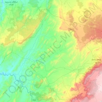
Name: Tigrigra topographic map, elevation, terrain.
Average elevation: 1,156 m
Minimum elevation: 750 m
Maximum elevation: 2,004 m
Other topographic maps
Click on a map to view its topography, its elevation and its terrain.
Sidi Addi
Maroc > cercle d'Azrou > Sidi El Makhfi
Sidi Addi, Sidi El Makhfi, caïdat Sidi Addi, cercle d'Azrou, Province d'Ifrane, Fès-Meknès, 53102, Maroc
Average elevation: 1,116 m
Timhadit
Timhadit, caïdat de Timahdite, cercle d'Azrou, Province d'Ifrane, Fès-Meknès, Maroc
Average elevation: 1,902 m