
Berkshire South topographic map
Interactive map
Click on the map to display elevation.
About this map
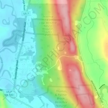
Name: Berkshire South topographic map, elevation, terrain.
Average elevation: 266 m
Minimum elevation: 206 m
Maximum elevation: 367 m
Other topographic maps
Click on a map to view its topography, its elevation and its terrain.
Root Orchards
United States > Massachusetts > Berkshire County > Great Barrington > Housatonic > Risingdale
Root Orchards, Willow's Trail (orange), Risingdale, Housatonic, Great Barrington, Berkshire County, Massachusetts, 01236, United States
Average elevation: 278 m
Housatonic
United States > Massachusetts > Berkshire County > Great Barrington
Housatonic, Great Barrington, Berkshire County, Massachusetts, 01236, United States
Average elevation: 291 m