
West End topographic map
Interactive map
Click on the map to display elevation.
About this map
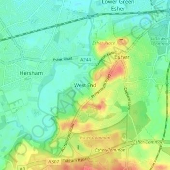
Name: West End topographic map, elevation, terrain.
Location: West End, Elmbridge, Surrey, England, KT10 8LY, United Kingdom (51.34275 -0.39929 51.38275 -0.35929)
Average elevation: 24 m
Minimum elevation: 8 m
Maximum elevation: 54 m
Other topographic maps
Click on a map to view its topography, its elevation and its terrain.
Esher
United Kingdom > England > Surrey > Elmbridge
Esher, Elmbridge, Surrey, England, KT10 9QU, United Kingdom
Average elevation: 27 m
Cobham
United Kingdom > England > Surrey > Elmbridge
Cobham, Elmbridge, Surrey, England, United Kingdom
Average elevation: 28 m